Travel Guide of Trollstigen in Norway by Influencers and Travelers
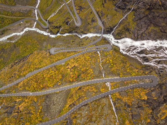
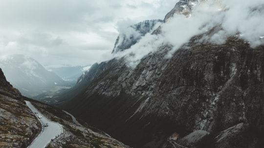
Trollstigen is a serpentine mountain road and pass in Rauma Municipality, Møre og Romsdal county, Norway. It is part of Norwegian County Road 63 that connects the town of Åndalsnes in Rauma and the village of Valldal in Norddal Municipality.
Download the Travel Map of Norway on Google Maps here
Pictures and Stories of Trollstigen from Influencers
9 pictures of Trollstigen from Shai Pal, Ivars Utināns, Lubo Minar and other travelers
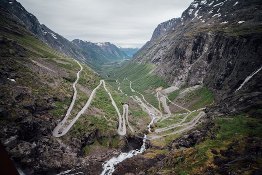
- one of 100 amazing views from our trip in Norway, the land I’ll always adore! ...click to read more
- Experienced by @Ivars Utināns | ©Unsplash
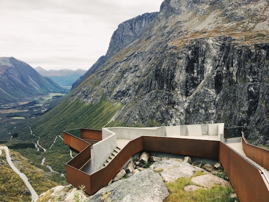
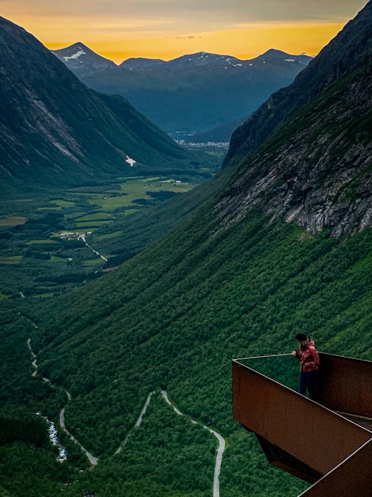
- Designed by Reiulf Ramstad Arkitekter. ...click to read more
- Experienced by @Paul Povoroznuk | ©Unsplash
Plan your trip in Trollstigen with AI 🤖 🗺
Roadtrips.ai is a AI powered trip planner that you can use to generate a customized trip itinerary for any destination in Norway in just one clickJust write your activities preferences, budget and number of days travelling and our artificial intelligence will do the rest for you
👉 Use the AI Trip Planner
Book your Travel Experience at Trollstigen
Discover the best tours and activities around Trollstigen, Norway and book your travel experience today with our booking partners
Map of Trollstigen
View Trollstigen on a map with the the closest popular places nearby
Download On Google Maps 🗺️📲
More Travel spots to explore around Trollstigen
Click on the pictures to learn more about the places and to get directions
Discover more travel spots to explore around Trollstigen
⛰️ Highland spots ⛰️ Hill station spots ❄️ Glacial landform spots ❄️ Tundra spots 🏞️ Waterfall spotsLearn More about Trollstigen
Trollstigen is a mountain road in Rauma, More og Romsdal county, Norway. It connects Andalsnes, in Rauma municipality, and Valldal, in Norddal municipality. The road is surrounded by several mountains over 3300 feet (1,000 m). Among others, Stigbotnhornet and Bispen, as well as Dronningen and the King in the north. A little further to the northeast, the best known are Trolltindan, Trollklorn and Trollveggen. The marked path to the top of Trollveggen starts at Stigrora.
The Trollstigen is a technical feat that took eight years to build and consists of eleven twists and turns carved into the side of a cliff. A feeling of vertigo seizes the traveler, especially since the road is very uneven. The Trollstigen is very narrow and not allowed to be driven by long vehicles, but it is a favorite playground for courageous and motivated cyclists.
The route is now one of the most popular tourist attractions in the country and is very busy in summer. The infrastructure is therefore particularly elaborate, and you will find at the top an information point with observation platforms, works of the Norwegian architect Reiulf Ramstad. The ideal place to admire the road below, and especially to embrace with one look the immensity of these extraordinary landscapes.
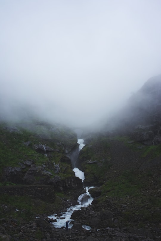
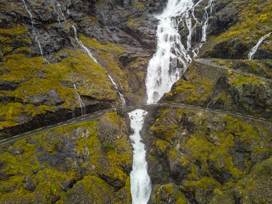
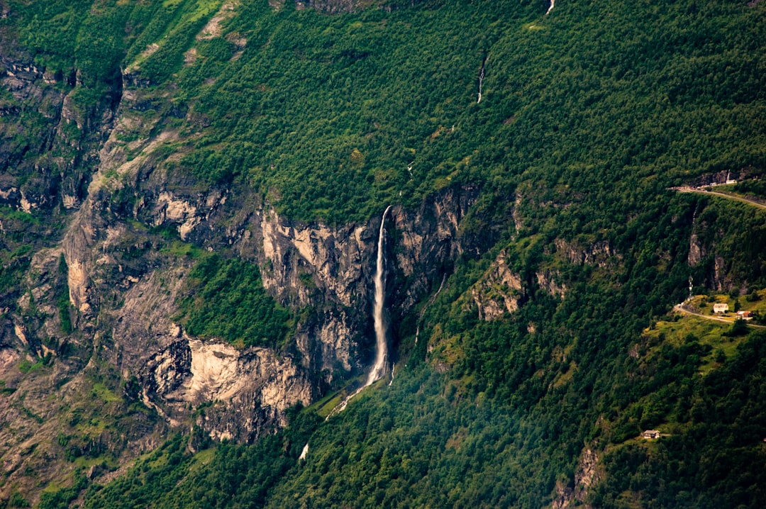
Driving the Trollstigen offers a summary of all the wonders of Norway in the heart of a wild and preserved nature. The road is dominated by rock formations. During the ascent, you can also admire the famous Stigfossen waterfalls. 590 feet (180 m) high, they seem to spring from the rock. This road leads through the majestic nature of western Norway, where the stunning landscape of rugged mountains is complemented by fertile valleys, waterfalls and deep fjords. The Eagle Road (Ornevegen ) will take you to an altitude of 2600 feet (800 m) where you will enjoy a breathtaking view of the Geiranger Fjord, a UNESCO World Heritage Site.
Trollstigen brings together everything you would want to see on a trip to Norway, impressive mountain scenery with its famous fjords, you won't be disappointed by the beauty of this hiking trail which offers splendid views of the region.
Frequently Asked Questions by Travelers planning a trip to Trollstigen
Trollstigen is not open all year round, the road closes in autumn and winter because it is dangerous to use its roads when there is snow and ice, the opening and closing dates change every year depending on the weather. The opening date is around May until October-November.
What is sure is that Oslo and Trollstigen are not next to each other, but if this is part of your travel itinerary, it will take you almost 6 hours by car to cover the 257 miles (445 km) that separate the two locations. The train R10 takes 6 hours and 45 minutes and arrives at Andalsnes station, so you have to take a cab to get to Trollstigen. Other options are to fly, take the ferry and several public means of transport, but these include many changes and stops, making the journey very long and expensive.
Where to Stay near Trollstigen
Discover the best hotels around Trollstigen, Norway and book your stay today with our booking partner booking.com
Popular destinations near Trollstigen
Disover the best Instagram Spots around Trollstigen here
