Travel Guide of Chaurikharka in Nepal by Influencers and Travelers
Chaurikharka is a village development committee in Solukhumbu District in the Sagarmatha Zone of northeastern Nepal. At the time of the 1991 Nepal census it had a population of 2422 people living in 502 individual households.
The Best Things to Do and Visit in Chaurikharka
TRAVELERS TOP 10 :
1 - Khumbu Pasanglhamu Rural Municipality ( खुम्बु-पासाङल्हामु-गाउँपालिका )
Khumbu Pasanglhamu is a rural municipality out of 7 rural municipalities located at Solukhumbu district of Province No. 1 of Nepal. Khumjung, Namche & Jubing and Chaurikharka were incorporated while creating it. It has the total population of 9,133 according to the 2011 Nepal census and area of 1,539.11 square kilometres. The admin centre of this gaunpalika is that of the Chaurikharka. Previously, Khumjung, Namche, Jubing and Chaurikharka were all separate local level body of Solukhumbu District. Solukhumbu was a district out of six districts of Sagarmatha Zone. Sagarmatha was a zone of Eastern development region of Nepal.
Learn more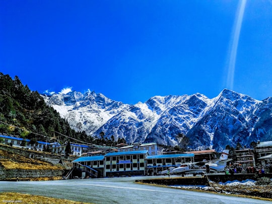
2 - Khumbu
9 km away
Khumbu is a region of northeastern Nepal on the Nepalese side of Mount Everest. It is part of the Solukhumbu District, which in turn is part of Province No. 1.
View on Google Maps Book this experience
3 - Trekking | Namche Bazar
13 km away
Nirekha Peak is listed in the list of new trekking peaks of Nepal.
Book this experience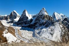
4 - Imja Khola
6 km away
The Imja Khola is a tributary of the Dudh Kosi in Nepal. It drains the slopes of Mount Everest. The Khumbu Glacier melts into the Lobujya River, which flows southward as the Imja Khola to its confluence with the Dudh Kosi at Tengboche.
View on Google Maps Book this experience
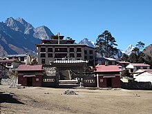
5 - Tengboche Monastery
11 km away
Tengboche Monastery, also known as Dawa Choling Gompa, in the Tengboche village in Khumjung in the Khumbu region of eastern Nepal is a Tibetan Buddhist monastery of the Sherpa community.
Learn more Book this experience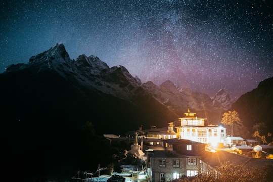
6 - Mera Peak
14 km away
Mera Peak is a mountain in the Mahalangur section, Barun sub-section of the Himalaya and administratively in Nepal's Sagarmatha Zone, Solukhumbu District. At 6,476 metres it is classified as a trekking peak.
Learn more Book this experience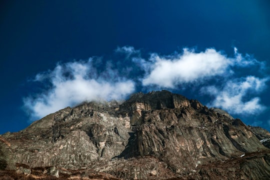
7 - Taboche
18 km away
Taboche is a mountain in the Khumbu region of the Nepalese Himalaya. Taboche is connected to Cholatse by a long ridge. Taboche lies directly across the Imja River from Ama Dablam and above the villages of Pheriche and Dingboche.
View on Google Maps Book this experience
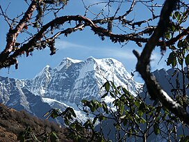
8 - Ama Dablam
19 km away
Ama Dablam is a mountain in the eastern Himalayan range of Province No. 1, Nepal. The main peak is 6,812 metres, the lower western peak is 6,170 metres.
Learn more Book this experience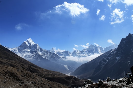

9 - Cholatse
20 km away
Cholatse is a mountain in the Khumbu region of the Nepalese Himalaya. Cholatse is connected to Taboche by a long ridge. The Chola glacier descends off the east face.
View on Google Maps Book this experience
10 - Sagarmatha National Park
22 km away
Sagarmāthā National Park is a national park in the Himalayas of eastern Nepal that is dominated by Mount Everest. It encompasses an area of 1,148 km² in the Solukhumbu District and ranges in elevation from 2,845 to 8,848 m at the summit of Mount Everest.
Learn more Book this experience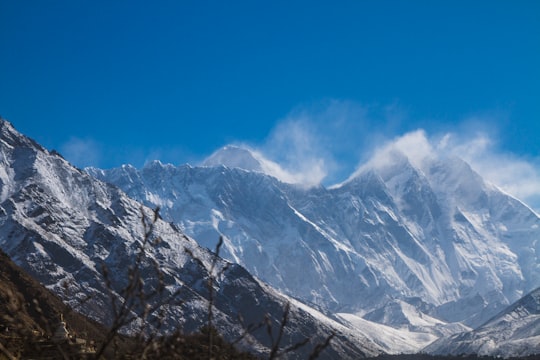

11 - Phaphlu
24 km away
Phaphlu is a mountainous town in north-east Nepal, approximately 270 kilometres east of the Nepalese capital, Kathmandu.
Learn more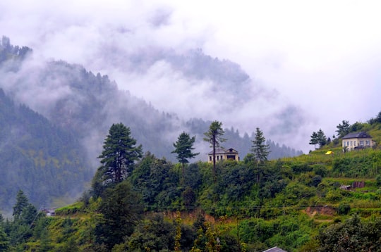
12 - Gokyo Ri
25 km away
Gokyo Peak is a 5,357 m-high peak in the Khumbu region of the Nepal Himalayas. It is located on the west side of the Ngozumpa glacier, which is the largest glacier in Nepal and reputed to be the largest in the whole Himalayas.
Learn more Book this experience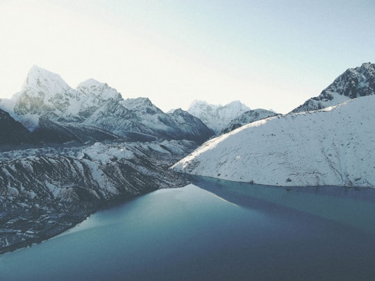

13 - Lobuche
25 km away
Lobuche is a Nepalese mountain which lies close to the Khumbu Glacier and the settlement of Lobuche. There are two main peaks, Lobuche East and Lobuche West.
Learn more Book this experience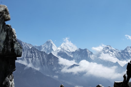

14 - Dingboche
25 km away
Dingboche 27°53′N 86°49′E is a Sherpa village in the Khumbu region of north eastern Nepal in the Chukhung Valley. Its population was estimated at approximately 200 in 2011. It is situated at an altitude of 4,410 metres.
Learn more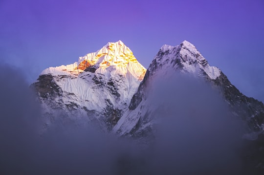
Disover the best Instagram Spots around Chaurikharka here
Book Tours and Activities in Chaurikharka
Discover the best tours and activities around Chaurikharka, Nepal and book your travel experience today with our booking partners
Plan your trip in Chaurikharka with AI 🤖 🗺
Roadtrips.ai is a AI powered trip planner that you can use to generate a customized trip itinerary for any destination in Nepal in just one clickJust write your activities preferences, budget and number of days travelling and our artificial intelligence will do the rest for you
👉 Use the AI Trip Planner
Where to Stay in Chaurikharka
Discover the best hotels around Chaurikharka, Nepal and book your stay today with our booking partner booking.com
More Travel spots to explore around Chaurikharka
Click on the pictures to learn more about the places and to get directions
Discover more travel spots to explore around Chaurikharka
⛰️ Hill station spotsTravel map of Chaurikharka
Explore popular touristic places around Chaurikharka