Travel Guide of Mýrdalsjökull in Iceland by Influencers and Travelers
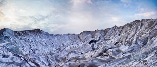
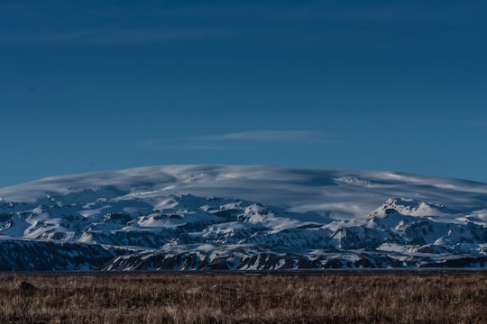
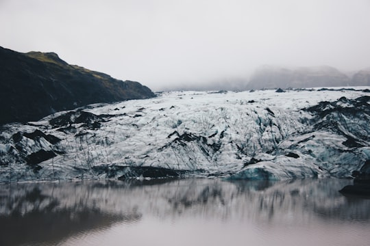
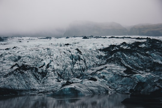
Mýrdalsjökull is an ice cap in the south of Iceland. It is to the north of Vík í Mýrdal and to the east of the smaller ice cap Eyjafjallajökull. Between these two glaciers is Fimmvörðuháls pass. Its peak reaches 1,493 m in height and in the year 1980 it covered an area of approximately 595 km². The icecap of the glacier covers an active volcano called Katla. The caldera of the volcano has a diameter of 10 km and the volcano erupts usually every 40–80 years. The last eruption took place in 1918.
Download the Travel Map of Iceland on Google Maps here
Pictures and Stories of Mýrdalsjökull from Influencers
7 pictures of Mýrdalsjökull from Jonatan Pie, Ruslan Valeev, Einar Jónsson and other travelers
Plan your trip in Mýrdalsjökull with AI 🤖 🗺
Roadtrips.ai is a AI powered trip planner that you can use to generate a customized trip itinerary for any destination in Iceland in just one clickJust write your activities preferences, budget and number of days travelling and our artificial intelligence will do the rest for you
👉 Use the AI Trip Planner
How to visit Mýrdalsjökull ?
Why traveling there?
Mýrdalsjökull is a spectacular glacier in southern Iceland, covering one of the country's most active volcanoes, Katla. This unique combination of ice and fire offers an exceptional experience for adventure seekers and nature lovers. Traveling to Mýrdalsjökull allows you to witness the breathtaking beauty of Iceland's landscapes and participate in various thrilling activities such as glacier hiking, ice climbing, and snowmobiling.
How to get there?
Mýrdalsjökull is located about 150 kilometers southeast of Reykjavik. The easiest way to get there is by renting a car or joining a guided tour from Reykjavik. The drive takes approximately 2.5 hours, and the route offers stunning views of Iceland's countryside. If you prefer public transportation, you can take a bus from Reykjavik to the nearby town of Vík, then join a local tour to the glacier.
What to book in advance?
It's essential to book your glacier-related activities in advance, as they are popular and can fill up quickly. These activities include guided glacier hikes, ice climbing, and snowmobiling tours. Booking in advance also allows you to secure a spot in your preferred accommodation, especially during the high season.
What are the costs?
The cost of visiting Mýrdalsjökull varies depending on the activities and accommodations you choose. Guided glacier hikes start at around $100 per person, while ice climbing and snowmobiling tours can range from $150 to $300 per person. Accommodations in the area range from budget-friendly guesthouses to more luxurious hotels, with prices starting at around $80 per night.
What are the best things to do?
Mýrdalsjökull offers numerous activities for visitors to enjoy:
1. Glacier hiking: Explore the stunning ice formations and crevasses with an experienced guide.
2. Ice climbing: Challenge yourself by scaling the ice walls of the glacier with specialized equipment.
3. Snowmobiling: Experience the thrill of riding a snowmobile across the vast icy landscape.
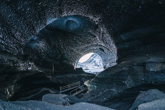
4. Exploring the ice caves: Discover the mesmerizing blue ice caves hidden beneath the glacier.
5. Visiting nearby attractions: Mýrdalsjökull's proximity to the South Coast allows you to explore other iconic sites such as Reynisfjara black sand beach and Skógafoss waterfall.
Where to eat?
1. Halldorskaffi: Located in the town of Vík, this cozy restaurant offers delicious Icelandic dishes and homemade pizzas.
2. Sudur-Vík: Enjoy a tasty meal with stunning ocean views at this family-run restaurant.
3. Strondin Bistro & Bar: Savor fresh seafood and local ingredients at this modern bistro in Vík.
Where to stay?
1. Puffin Hostel Vík: Budget-friendly accommodation offering clean and comfortable rooms in the heart of Vík.
2. Icelandair Hotel Vík: A modern hotel with stunning views, comfortable rooms, and an on-site restaurant.
3. Black Beach Suites: Spacious self-catered apartments with kitchen facilities and beautiful ocean views.
Off the beaten path
For an unusual travel experience, explore the abandoned DC-3 plane wreckage on Sólheimasandur black sand beach. This haunting site is a photographer's dream and offers an eerie contrast to the surrounding natural beauty. The wreckage is accessible via a 4-kilometer hike from the main road and takes you through the vast, otherworldly landscape of the black sand desert.
The Best Things to Do and Visit around Mýrdalsjökull
Disover the best Instagram Spots around Mýrdalsjökull here
1 - Katla volcano
Katla is a large volcano in southern Iceland. It is very active; twenty eruptions have been documented between 930 and 1918, at intervals of 20–90 years.
Learn more Book this experience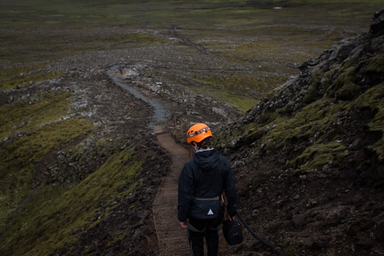

2 - Sólheimajökull
13 km away
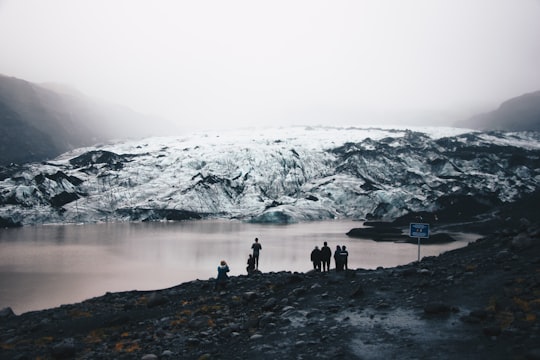
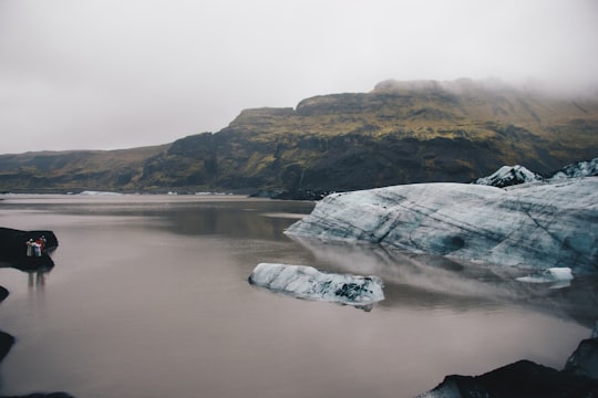
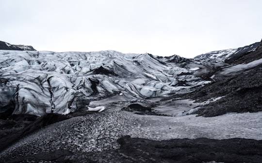
Sólheimajökull is a glacier in southern Iceland, between the volcanoes Katla and Eyjafjallajökull. Part of the larger Mýrdalsjökull glacier, Sólheimajökull is a prominent and popular tourist location owing to its size and relative ease of access.
Learn more Book this experience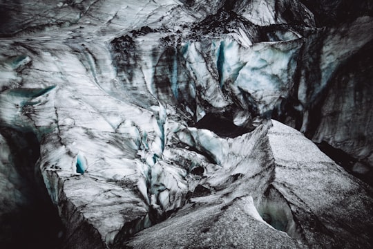
3 - Quad Biking / Buggy Tours in Vik i Myrdal
20 km away
Enjoy an adventure on Iceland's famous black sand beaches on a quad bike excursion near Vík í Mýrdal and the Mýrdalsjökull glacier!From a spot at the foot of the Mýrdalsjökull glacier, this quad bike ride along the black sandy beaches nea...
Learn more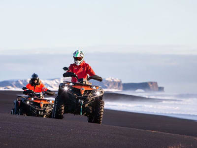
4 - Fimmvörðuháls
18 km away
Fimmvörðuháls is the area between the glaciers Eyjafjallajökull and Mýrdalsjökull in southern Iceland. The route between Skógar and Thórsmörk goes through this pass and is one of the most popular walking routes in Iceland, despite being 22 kilometres long and involving 1,000 metres of climbing.
View on Google Maps Book this experience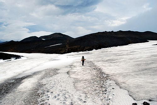
5 - Thórsmörk
19 km away
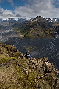
Thórsmörk is a mountain ridge in Iceland that was named after the Norse god Thor. It is situated in the south of Iceland between the glaciers Tindfjallajökull and Eyjafjallajökull.
Learn more Book this experience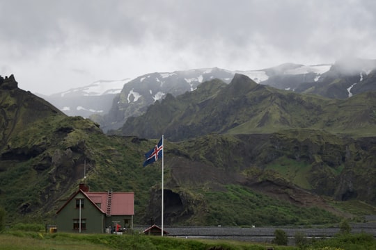
6 - Snowmobiling in Vik i Myrdal
20 km away
Are you looking for a lifetime adventure in Iceland? Join this exciting snowmobile ride near Vík and throttle up the Mýrdalsjökull glacier! The Mýrdalsjökull glacier is an icecap covering Iceland's fourth-largest ...
Learn more
7 - Álftavatn
24 km away
Learn more
8 - Skógafoss
26 km away
Skógafoss is a waterfall situated on the Skógá River in the south of Iceland at the cliffs of the former coastline. After the coastline had receded seaward, the former sea cliffs remained, parallel to the coast over hundreds of kilometres, creating together with some mountains a clear border between the coastal lowlands and the Highlands of Iceland.
Learn more Book this experience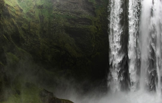

9 - Quad biking in Vik i Myrdal
20 km away
Enjoy an adventure on Iceland's famous black sand beaches on a quad bike excursion near Vík í Mýrdal and the Mýrdalsjökull glacier! From a spot at the foot of the Mýrdalsjökull glacier, this quad bike ride...
Learn more
10 - Eyjafjallajökull
26 km away
Eyjafjallajökull is one of the smaller ice caps of Iceland, north of Skógar and west of Mýrdalsjökull. The ice cap covers the caldera of a volcano with a summit elevation of 1,651 metres.
Learn more Book this experience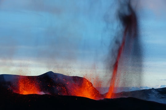

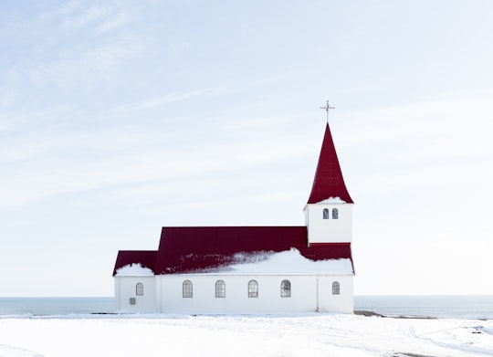
11 - Vik i Myrdal Church
26 km away
Learn more
12 - Glacier hiking in Reykjavik
20 km away
Take a walk on the ice side on this magical day trip from Reykjavík to the majestic Sólheimajökull glacier with special stops along the way. Located only 160 km from Reykjavík, this is currently one of the most accessib...
Learn more
13 - Reynisfjara Beach
27 km away
Learn more
14 - Dyrhólaey Lighthouse
29 km away
The Dyrhólaey Lighthouse is a lighthouse located on the central south coast of Iceland.
Learn more Book this experience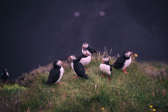

15 - Dyrhólaey
30 km away
Dyrhólaey, formerly known by seamen as Cape Portland, is a small promontory located on the south coast of Iceland, not far from the village Vík. In fact, Dyrhólaey is the southernmost point in mainland Iceland. It was formerly an island of volcanic origin, which is also known by the Icelandic word eyja meaning island.
Learn more Book this experience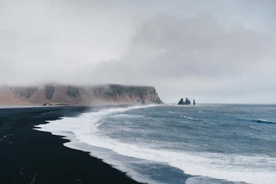
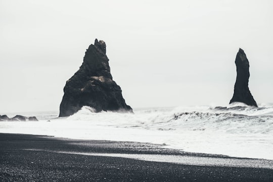
16 - Reynisdrangar
30 km away
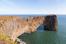
Reynisdrangar are basalt sea stacks situated under the mountain Reynisfjall near the village Vík í Mýrdal, southern Iceland which is framed by a black sand beach that was ranked in 1991 as one of the ten most beautiful non-tropical beaches in the world.
Learn more Book this experience

17 - Landmannalaugar
38 km away
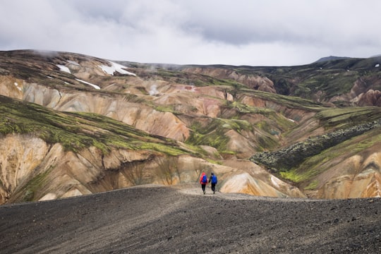
Landmannalaugar is a place in the Fjallabak Nature Reserve in the Highlands of Iceland. It is at the edge of Laugahraun lava field, which was formed in an eruption around the year 1477.
Learn more Book this experience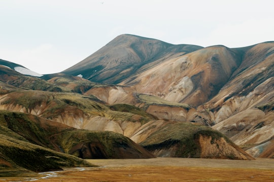

18 - Friðland að Fjallabaki
40 km away
Learn more

Book Tours and Activities in Mýrdalsjökull
Discover the best tours and activities around Mýrdalsjökull, Iceland and book your travel experience today with our booking partners
Where to Stay near Mýrdalsjökull
Discover the best hotels around Mýrdalsjökull, Iceland and book your stay today with our booking partner booking.com
More Travel spots to explore around Mýrdalsjökull
Click on the pictures to learn more about the places and to get directions
Discover more travel spots to explore around Mýrdalsjökull
❄️ Glacial landform spots Cave spots ❄️ Glacier spots ⛰️ Hill spotsTravel map of Mýrdalsjökull
Explore popular touristic places around Mýrdalsjökull
Download On Google Maps 🗺️📲
