Travel Guide of Telfs in Austria by Influencers and Travelers
Telfs is a market town in the district of Innsbruck-Land in the Austrian state of Tyrol, 27 kilometres west of Innsbruck. It is the third largest municipality in Tyrol. Telfs received its status in 1908 and maintains its own district court.
The Best Things to Do and Visit in Telfs
TRAVELERS TOP 10 :
1 - Leutasch
9 km away
Leutasch is a municipality in the northern part of the district Innsbruck-Land in the Austrian state of Tyrol about 30 km northwest of Innsbruck and 10 km northwest of Seefeld in Tirol
Learn more
2 - Seebensee
10 km away
The Seebensee is a natural high mountain lake at a height of 1,657 metres, south of Ehrwald in the Mieming Range. It is surrounded by the Vorderer Tajakopf in the east, the Vorderer Drachenkopf in the south and the Ehrwalder Sonnenspitze in the west.
Learn more Book this experience
3 - Rafting in Ötztal
15 km away
Take to the rapids on one of the most famous white water spots in the world!This challenging adventure is the perfect opportunity to learn the ins and outs of the white water rafting while discovering the beautiful Imst Gorge and everything it has to...
Book this experience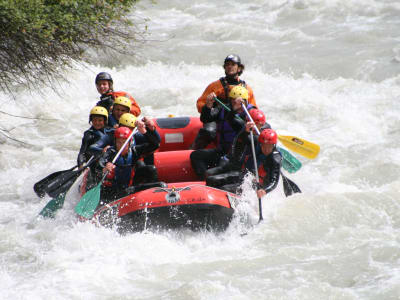
4 - Wankspitze
10 km away
Wankspitze is a summit of the Mieming Range in the Austrian state of Tyrol. It separates the Griessspitzen to the north from the Mieming Plateau to the south.
Learn more Book this experience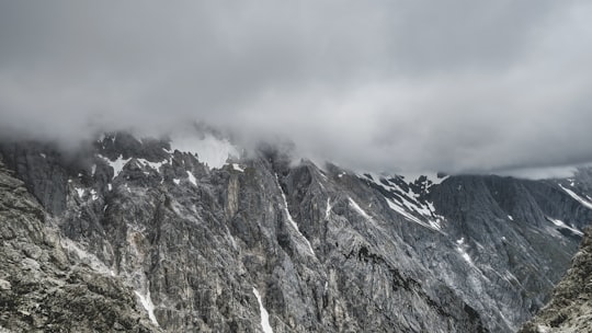
5 - Finstertalspeicher
13 km away
Finstertalspeicher is a reservoir in Tyrol, Austria.
Learn more Book this experience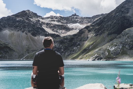
6 - Canyoning in Zugspitze
15 km away
Fancy a jump'n fun adventure with your friends? If you want to discover new impressions and outdoor activities, then head for the Zugspitze! Varied beginner's canyoning tour. Abseils up to 32 metres, many jumps from different heights up to 10 metres ...
Book this experience
7 - Sellrain
15 km away
Sellrain is a municipality in the district of Innsbruck-Land in the Austrian state of Tyrol located 14.40 km southwest of Innsbruck in the Sellrain Valley. The Melach River and its tributary the Fotscherbach flow through it. Most people in the village are farmers and also have another job in the neighboring Innsbruck. There are two Catholic churches in the village St. Quirin and St. Anna. They are both over 300 years old.
Learn more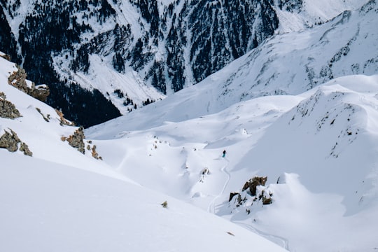
8 - Scharnitz
18 km away
Scharnitz is a municipality in the district of Innsbruck-Land in the Austrian state of Tyrol located 16.4 kilometres north of Innsbruck and 9 kilometres from Seefeld in Tirol on the German border.
Learn more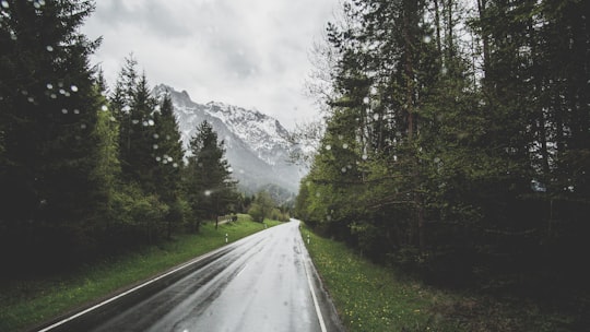
9 - Mountain bike in Ötztal
15 km away
Alpine views and serious highs – explore the Otzal Valley in the saddle… Home to some of the most extreme enduro and single track routes in the Tyrolean Alps, when it comes to serious downhill fun, the Otzal Valley is the gold standard. ...
Book this experience
10 - Eibsee
21 km away
Eibsee is a lake in Bavaria, Germany, 9 km southwest of Garmisch-Partenkirchen and roughly 100 km southwest of Munich. It is 973.28 metres above sea-level and its surface area is 177.4 hectares.
Learn more Book this experience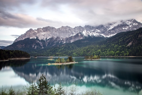

11 - Umhausen
23 km away
Umhausen is a municipality in the Imst district of state of Tyrol in western Austria. It and is located 17 km southeast of Imst at the Ötztaler Ache in the Ötztal. It has 3078 inhabitants.
Learn more
12 - Via Ferrata in Ötztal
15 km away
Clip in and don't look back at Lehner Waterfall in Tyrol Once you commit to following the iron road, the only way is forward – exploring the highs and lows of Lehner Waterfall on this fixed via ferrata course in the heart of the Austrian ...
Book this experience
13 - Golden Roof
25 km away
The Goldenes Dachl is a landmark structure located in the Old Town section of Innsbruck, Austria. It is considered the city's most famous symbol.
Learn more Book this experience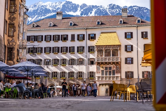

14 - Hungerburgbahn Bergstation
25 km away
The Hungerburgbahn is a hybrid funicular railway in Innsbruck, Austria, connecting the city district of Hungerburg with the city centre. The current line opened on 1 December 2007, replacing a previous alignment that operated from 1906 to 2005.
Learn more Book this experience
15 - Hiking | Ehrwald
15 km away
Learn Hiking in Snowshoes from professional Instruktors in awesom environment
Book this experience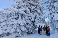
16 - Innsbruck
26 km away
Innsbruck is the capital city of Tyrol and the fifth-largest city in Austria. It is in the Inn valley, at its junction with the Wipp valley, which provides access to the Brenner Pass some 30 km to the south.
Learn more
17 - Plansee
27 km away
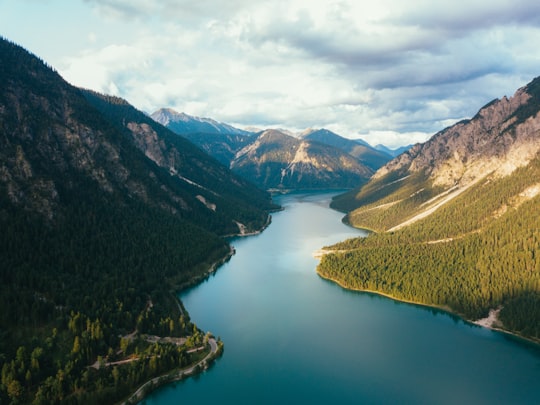
Plansee is a lake in the Tyrol, Austria, located at 47°28′10″N 10°48′20″E. Its surface is approximately 2.87 km² and its maximum depth is 78 metres. It lies on Austrian Federal Highway B 179, which crosses the Ammersattel into Germany.
Learn more Book this experience
18 - Stubaital
28 km away
The Stubaital is an alpine valley in Tyrol, Austria. It is the central valley of the Stubai Alps. The river Ruetz flows through the valley.
Learn more Book this experience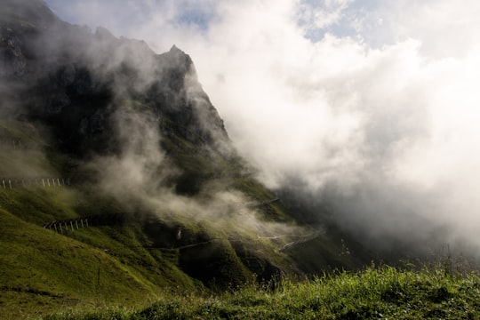
Disover the best Instagram Spots around Telfs here
Book Tours and Activities in Telfs
Discover the best tours and activities around Telfs, Austria and book your travel experience today with our booking partners
Pictures and Stories of Telfs from Influencers
Picture from Paul Gilmore who have traveled to Telfs

Plan your trip in Telfs with AI 🤖 🗺
Roadtrips.ai is a AI powered trip planner that you can use to generate a customized trip itinerary for any destination in Austria in just one clickJust write your activities preferences, budget and number of days travelling and our artificial intelligence will do the rest for you
👉 Use the AI Trip Planner
Why should you visit Telfs ?
Travel to Telfs if you like:
⛰️ HillWhere to Stay in Telfs
Discover the best hotels around Telfs, Austria and book your stay today with our booking partner booking.com
More Travel spots to explore around Telfs
Click on the pictures to learn more about the places and to get directions
Discover more travel spots to explore around Telfs
⛰️ Highland spots ⛰️ Hill spots ⛰️ Mountain spots ⛰️ Mountain range spotsTravel map of Telfs
Explore popular touristic places around Telfs